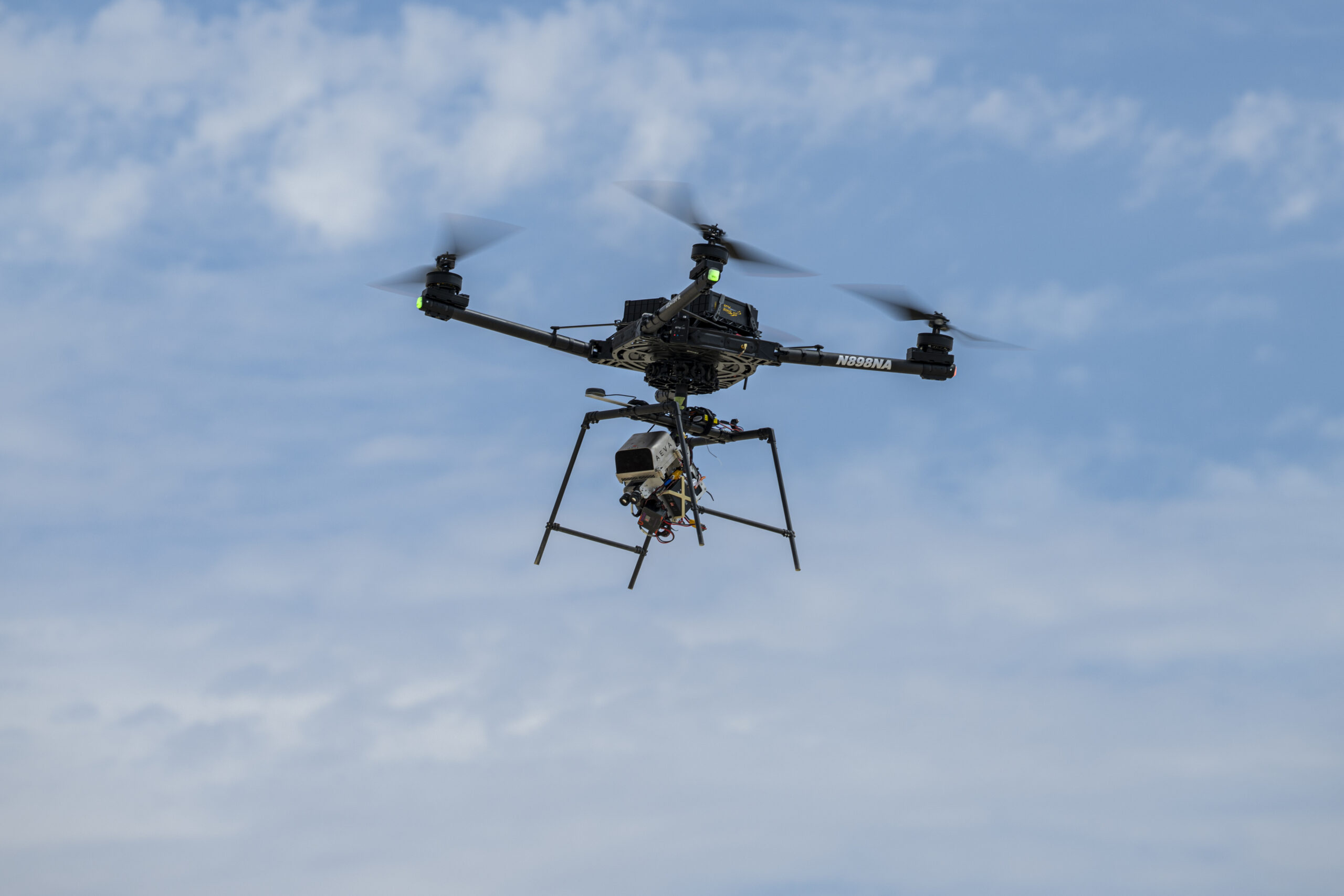
A drone flight over California’s Rogers Dry Lake is helping NASA prepare spacecraft to choose safer landing spots on other worlds. In a report published November 4, the agency described a successful demonstration of SPLICE, a guidance, navigation and control system designed for precise planetary landings.
The flight took place on August 27, not on the publication date. An Alta-X drone carried the experiment through simulated lunar descent and landing maneuvers near NASA’s Armstrong Flight Research Center in Edwards, California. NASA had previously shared an image of that flight; the new account adds detail about the integration work and the next stage of testing.
Choosing a place to touch down
SPLICE stands for Safe and Precise Landing–Integrated Capabilities Evolution. During the drone experiment, its guidance system mapped the terrain and assessed possible landing areas. The system is designed to redirect a vehicle if its original target proves unsafe. High-resolution elevation maps turn sensor measurements into a representation of the ground that the navigation software can evaluate.
Researchers at Johnson Space Center developed the payload, while Armstrong specialists helped integrate it with the drone. Tests in June and July checked communications, data handling, telemetry and command-and-control performance. NASA says that work prepared the team for a full-scale test at Voyager Technologies in Mojave, California, planned for later in November.
Several tools work together
The broader SPLICE architecture combines sensors, software and computing rather than relying on one measurement. Terrain-relative navigation compares live camera images with previously collected orbital imagery to establish where a spacecraft is. Navigation Doppler lidar uses returning laser signals to estimate altitude and velocity.
A separate hazard-detection lidar builds a three-dimensional view of the landing field. Software examines that terrain for hazards such as rocks and steep slopes, while the descent-and-landing computer processes the information and supports selection of a safer site. Guidance then has to translate that selection into a trajectory the vehicle can actually fly.
These jobs address different questions: where the vehicle is, how it is moving, what lies below, and how to reach an acceptable touchdown point. Integrating the answers is essential when the surface is approaching and a late change must remain within the vehicle’s capabilities.
A terrestrial test with a planetary purpose
NASA’s earlier flight-image release described the technology’s intended application to the Moon, Mars, icy worlds and other destinations. Reaching scientifically valuable terrain can require navigating near features that make a landing difficult. Better onboard assessment could help missions approach those locations more precisely.
The California demonstration is a development milestone, not proof that the complete system has performed a lunar landing. A drone over a dry lake does not reproduce every condition a planetary lander will face. Its value is in exercising the connected navigation and guidance functions on a moving vehicle before more demanding tests.
The next reported step is the planned full-scale Mojave test. For now, the August flight gives engineers evidence that the payload and flight platform can work together while carrying out a simulated descent.
Featured image: An Alta-X drone flies the SPLICE experiment near NASA Armstrong on August 27, 2026. Credit: NASA/Ryan Kline. Image licence.
Leave a Reply