DARK FIRESORIGINS UNKNOWN

Author: Dark Fires

  • Sentinel-3C’s First Thermal Images Add a New Test Before Routine Service

    Sentinel-3C’s First Thermal Images Add a New Test Before Routine Service

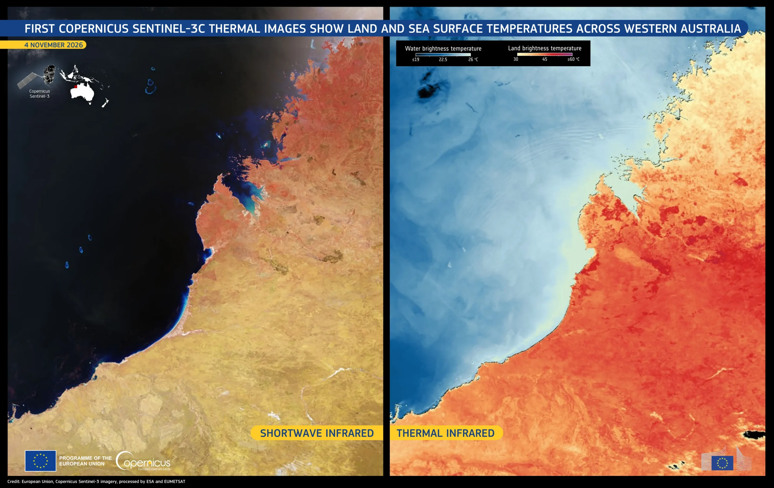
    ESA released the first thermal imagery from Sentinel-3C’s Sea and Land Surface Temperature Radiometer on November 18, 2026. The milestone tests a different instrument capability from the satellite’s earlier optical views, and does not mean commissioning is complete.

    Two views of Western Australia

    A November 4 acquisition covers the Kimberley region. The accompanying Copernicus graphic places a shortwave-infrared view on the left and a thermal view on the right. They encode different information: the former helps distinguish land-cover features, while thermal colors depict brightness-temperature contrasts.

    Brightness temperature is derived from radiation reaching the instrument at the top of the atmosphere. It should not be read as a direct thermometer measurement at every colored patch of ground. Nor are the false colors the landscape’s appearance to a human observer.

    First images are a milestone, not the finish

    Sentinel-3C launched on September 15. Its radiometer has nine spectral bands and two additional channels dedicated to detecting fires. The November release also includes imagery acquired November 2 over southwestern Europe and northern Africa.

    The new views demonstrate that the instrument is producing useful observations, but calibration and commissioning remain distinct from a successful first image. That distinction is important for a mission intended to contribute consistent measurements over time.

    Sources: ESA’s first-radiometer-images release; European Union Copernicus image description.

    Featured image: Kimberley region, Western Australia, November 4, 2026; shortwave infrared at left and thermal infrared at right. Contains modified Copernicus Sentinel data 2026. Credit: European Union, processed by ESA and EUMETSAT. This is satellite observation imagery, not an artist’s illustration.
  • Webb’s Dust Measurements Trace an Andromeda Stellar Merger

    Webb’s Dust Measurements Trace an Andromeda Stellar Merger

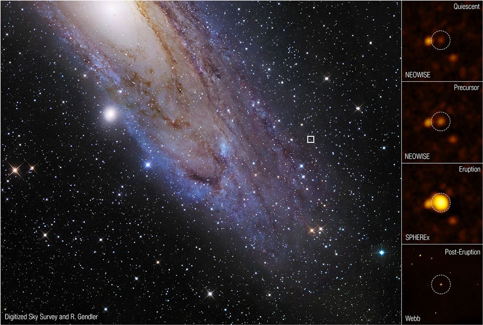
    NASA reported on November 18, 2026 that observations of AT 2025abao, nicknamed Bao, trace a stellar merger in the outskirts of the Andromeda galaxy. The strength of the result lies in combining observations before, during and after the eruption, rather than interpreting a single bright flash.

    An event assembled across years

    Archival NEOWISE measurements drew attention in 2023. WINTER observations detected dust in September 2024, and the Zwicky Transient Facility caught the eruption on October 17, 2025. Webb observed the aftermath on December 24, 2025, about 47 days after peak brightness. Its mid-infrared measurements characterized expelled dust and strengthened the merger interpretation.

    NASA describes a smaller companion interacting with a supergiant. The approximate stellar masses, 0.7 and seven times the Sun’s mass, and the supergiant’s roughly 350-solar-radius size are model estimates, not stars resolved as separate disks. The reconstruction places the final merger after about seven years and seven orbits of interaction.

    Why the infrared record matters

    The combined timeline links a dusty precursor to an eruption and its aftermath. It is a stronger test of the physical explanation than brightness alone because the model must account for several stages seen by different instruments.

    Andromeda is about 2.5 million light-years away. The dates here refer to observations received at Earth, not a merger happening nearby in the present. Continued monitoring is needed to establish how the remnant evolves.

    Source: NASA’s November 18 release. Observational image and caption.

    Featured image: Observational composite locating AT 2025abao in Andromeda and showing stages of the event. Credit: NASA, ESA, CSA, STScI, Viraj Karambelkar (Columbia), Kishalay De (Columbia). Image processing: Alyssa Pagan (STScI). Acknowledgment: DSS, Robert Gendler. This is observational imagery, not an artist’s reconstruction.

  • Dawn Radar Rings Can Be Birds, Not Phantom Targets

    Dawn Radar Rings Can Be Birds, Not Phantom Targets

    An expanding ring on weather radar can look artificial, yet its cause may be thousands of birds leaving a shared roost. Unlike an electronic artifact, this is a detection of physical targets. The unusual geometry comes from many animals dispersing in different directions at dawn.

    A pattern with a biological explanation

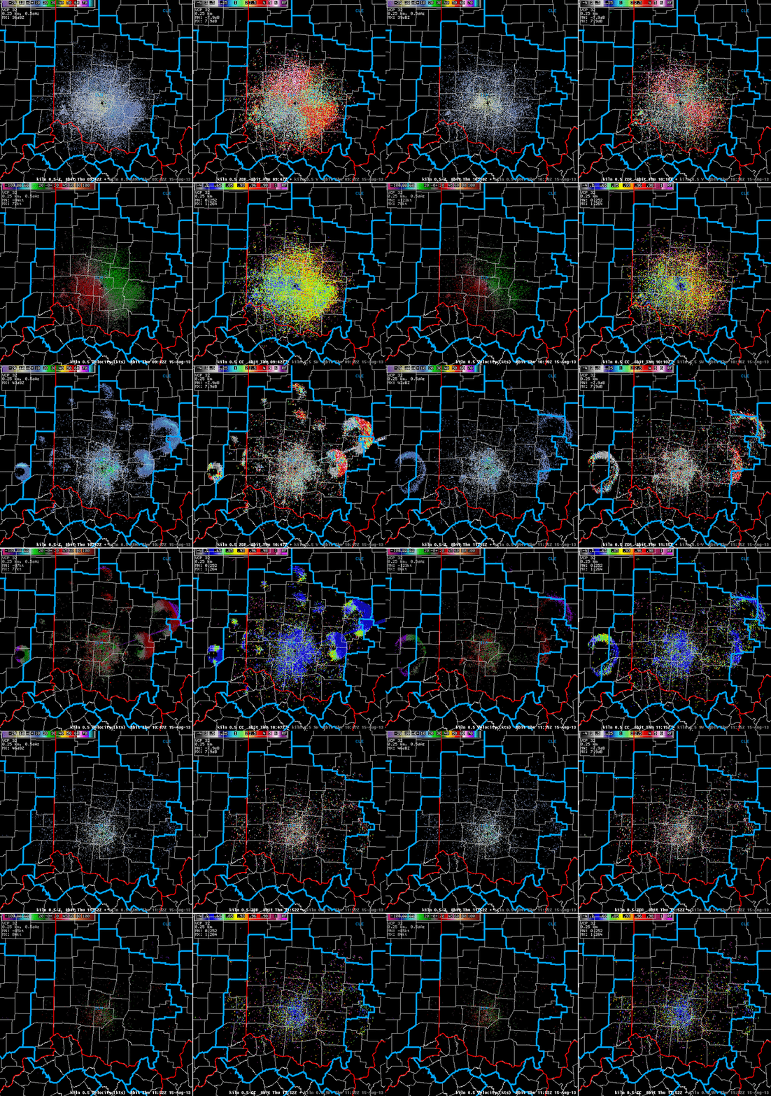
    The National Weather Service’s Wilmington office documents recurring rings on August 2–3, 2010 and August 15, 2013. Birds climbing into the radar beam become visible; spreading out and moving out of the sampled altitude makes the ring weaken. A separate Green Bay example records departures from Green Island in 2006 and 2010.

    Repeated locations and timing near sunrise are useful clues. They are not a rule that every circular radar pattern must be birds. Weather, beam geometry and other targets still matter.

    More than one radar product

    Wilmington’s four-panel 2013 example adds correlation coefficient to reflectivity and velocity. Low correlation coefficient indicates varied scattering characteristics consistent with non-weather targets in this case. It helps separate the roost echoes from more uniform precipitation, but is not by itself a species detector.

    That distinction matters when interpreting unidentified radar returns. A real echo does not automatically mean a vehicle, and a puzzling pattern need not be a faulty instrument. Biological targets offer a third possibility that should be tested against the time sequence and supporting data.

    For an unfamiliar screenshot, ask for the full sequence, radar location, timestamp and product names before inferring motion or identity. A cropped still loses the sunrise-linked expansion that makes these examples understandable.

    Sources: NWS Wilmington’s roost-ring explanation and multi-product animation; NWS Green Bay’s Green Island observations.

    Featured image: NWS Wilmington dual-polarization radar sequence, August 15, 2013. Reflectivity upper left, differential reflectivity upper right, velocity lower left and correlation coefficient lower right. Credit: NOAA/National Weather Service.

  • Voyager 1 Reaches One Light-Day, With Confirmation Still Traveling Home

    Voyager 1 Reaches One Light-Day, With Confirmation Still Traveling Home

    NASA says Voyager 1 reached a distance of one light-day from Earth on November 18, 2026. Its announcement carries an important qualification: the agency is still awaiting the spacecraft’s confirmation signal.

    A light-day is a distance, not a date or a new boundary in space. It is how far light travels in 24 hours, approximately 16 billion miles, or 26 billion kilometers. At that separation, information cannot arrive instantly, even when a spacecraft’s predicted trajectory tells mission planners when a milestone should occur.

    The distinction matters for headlines. NASA’s milestone announcement and receipt of a signal are separate events. A report that confirmation is still traveling should not be rewritten as a newly received message from the probe.

    NASA scheduled a mission discussion for November 19 at noon Eastern, covering the two Voyagers’ status, their interstellar science and the challenges of operating at such distances. That update is the next announced opportunity to hear directly from mission leadership.

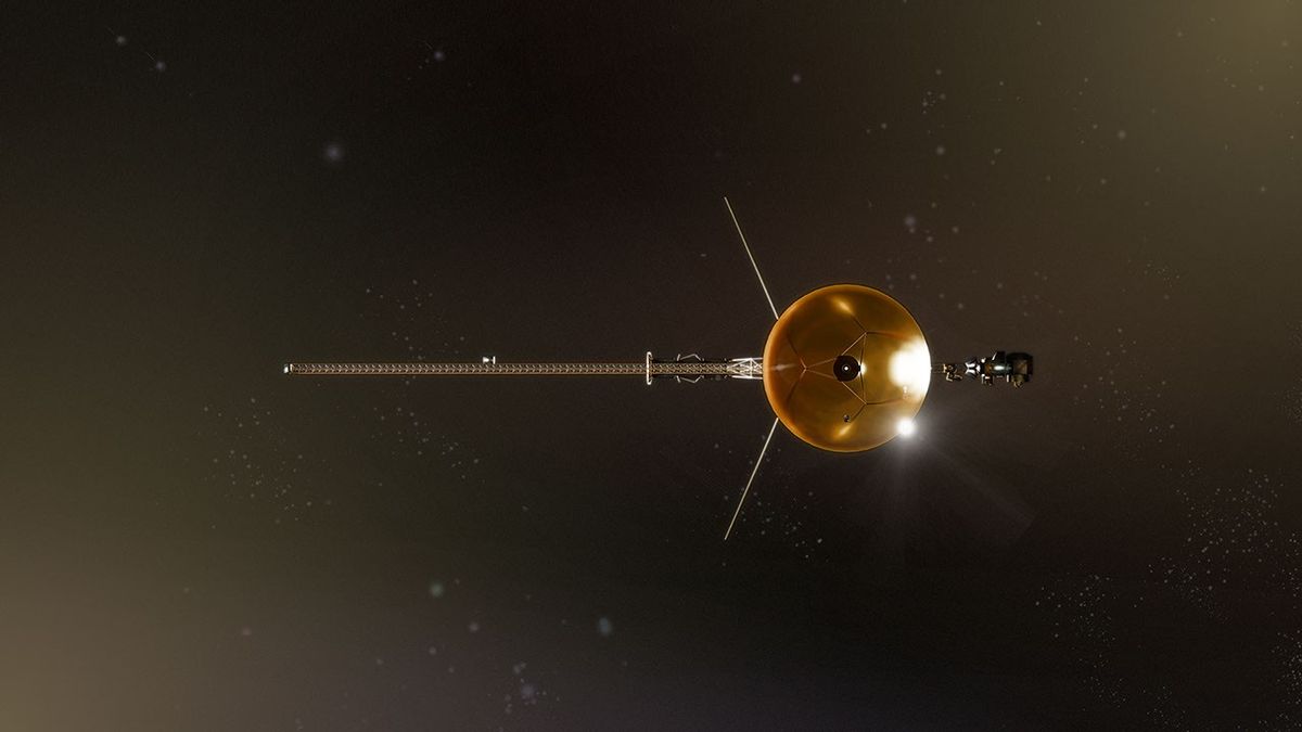
    Source: NASA Science’s November 18 milestone announcement. Featured image: artist’s concept of Voyager 1, from NASA’s one-light-day artwork.

  • Why Mariner 9 Stayed to Watch the Dust Settle

    Why Mariner 9 Stayed to Watch the Dust Settle

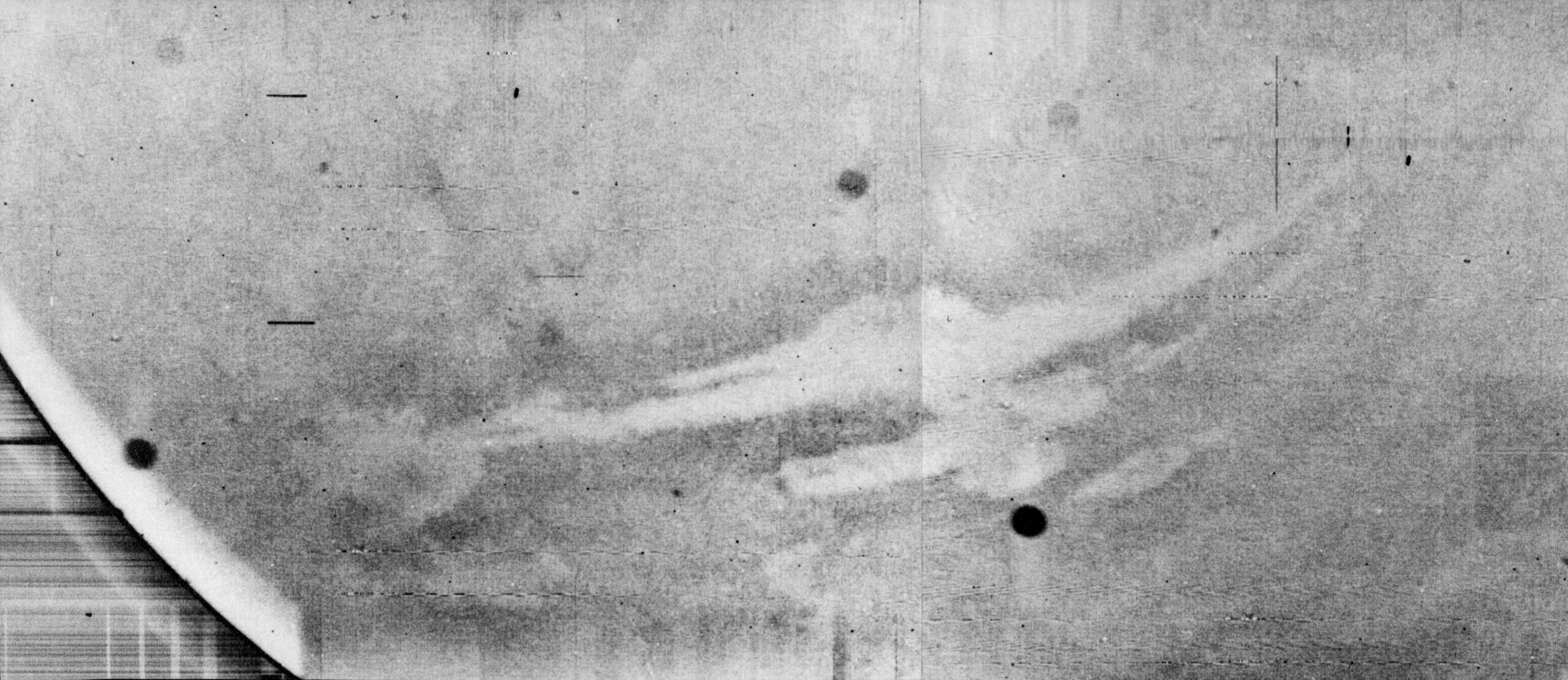
    In November 1971, Mariner 9 became the first spacecraft to orbit another planet. Mars was in the grip of a global dust storm, and much of the surface the spacecraft had been sent to map was hidden.

    A flyby camera would have had to take whatever Mars offered at the moment of closest approach. Mariner 9 could return to the same world over and over. While dust obscured most landmarks, the spacecraft turned its cameras on Phobos and Deimos and returned the first detailed pictures of the small moons.

    Once the dust started clearing, landforms came into view that looked nothing like the relatively uniform, cratered Mars suggested by earlier flyby photographs. The mission revealed giant volcanoes and the canyon system now called Valles Marineris. It ultimately mapped about 85 percent of the planet. The storm had delayed one objective, but repeated passes turned a bad first look into a record of change.

    Sources: NASA mission history; canyon image PIA02998, NASA/JPL.

  • MAVEN’s Argon Clue to Mars’s Lost Atmosphere

    MAVEN’s Argon Clue to Mars’s Lost Atmosphere

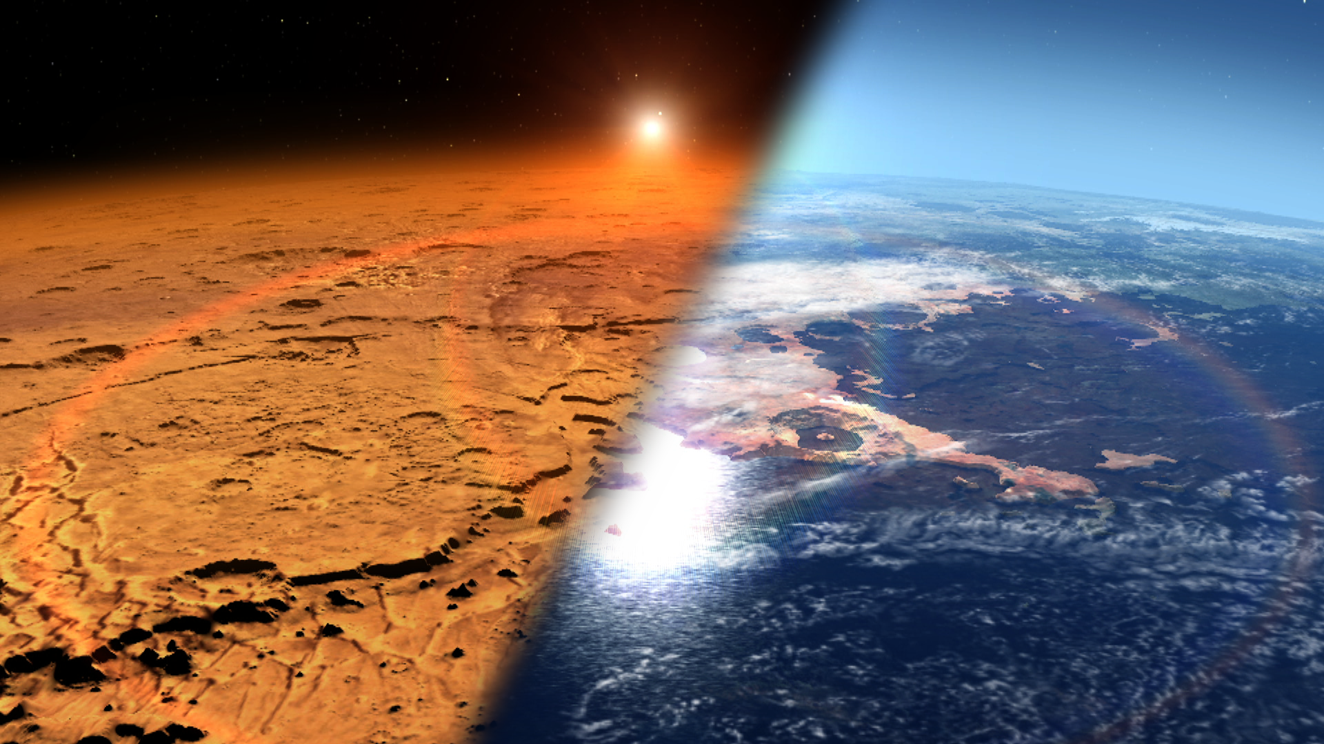
    A thin atmosphere tells you what Mars has now, but not what it once had. In a study reported in March 2017, NASA’s MAVEN team used two forms of argon to estimate how much of that gas had escaped over the planet’s history.

    The two isotopes are chemically alike but differ in mass. The lighter one escapes more readily, leaving the remaining atmosphere relatively enriched in the heavier isotope. To read that imprint, researchers combined MAVEN measurements of the upper atmosphere with measurements made on the ground by the Curiosity rover.

    The team estimated that Mars had lost about 65 percent of its atmospheric argon to space. That figure is for argon, not a direct measurement of the fraction of the entire ancient atmosphere lost. Because argon is chemically unreactive, its isotope ratio helped the team estimate the contribution of sputtering, in which energetic particles knock atmospheric atoms into space. That gave researchers a way to constrain loss of other gases, including carbon dioxide.

    Source: NASA’s March 2017 report. Featured artist’s concept: NASA Goddard Space Flight Center.

  • Swan Lake, 1965: A Real Photographic Object Was Not a Measured Flying Craft

    Swan Lake, 1965: A Real Photographic Object Was Not a Measured Flying Craft

    A New York college student photographed an unusual object at Swan Lake on September 27, 1965. The resulting Air Force file makes a useful distinction: accepting that a photograph depicts a real object does not establish what that object is.

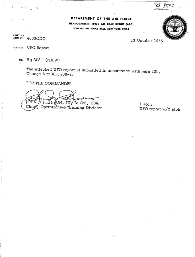
    The National Archives reproduces an October 13 survey and September 14, 1966 correspondence in its historical review. Initial photographic assessment treated the object as real, but investigators still needed information about the circumstances. Its distance from the camera was not established. The combined location and movement evidence strongly suggested a weather balloon.

    Why distance changes the question

    A picture records angular appearance. Without a reliable distance, it cannot by itself determine physical size or convert apparent movement into a measured speed. A close, small object and a distant, larger object can occupy a similar portion of a frame. This is an evidentiary limitation, not a claim that all unusual photographs share one explanation.

    The Swan Lake record therefore should not be presented as official confirmation of extraordinary technology merely because the photographed object was considered real. Nor should the balloon assessment be embellished into a precise trajectory that the cited material does not provide.

    Keep the file’s stages separate

    The original sighting, the collection of witness information, the photographic assessment and the later explanatory correspondence answer different questions. Reading them together shows why a single favorable phrase lifted from an investigation can misrepresent its conclusion.

    This article reviews a 1965 case through documents reproduced by the Archives in 2018. It is not a new sighting or a new release.

    Read the National Archives case review and reproduced Air Force records.

    Featured image: U.S. Air Force UFO report, October 13, 1965. Records of Headquarters U.S. Air Force, National Archives. Public-domain government record.

  • Weather Delays Dragon’s Return While Station Science Is Packed for Earth

    Weather Delays Dragon’s Return While Station Science Is Packed for Earth

    NASA and SpaceX stood down from Dragon’s November 18 undocking opportunity because weather was unfavorable at the California splashdown sites. NASA’s afternoon update described continued preparations aboard the International Space Station, not a completed departure or return.

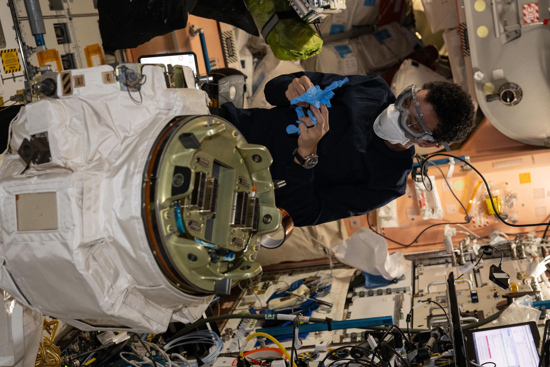
    The cargo includes samples from investigations involving 3D-bioprinted blood vessels and antibiotic-resistant bacteria. Astronauts also packed crew blood samples and research material preserved in specialized storage equipment. A circadian lighting system is headed back for evaluation, alongside a spacesuit needing refurbishment.

    Those details explain why the return leg is part of the research rather than merely a delivery service in reverse. Physical samples and hardware give ground teams material to examine after their time in microgravity. Packing them does not establish the experiments’ eventual findings.

    The spacecraft arrived at the station on October 15. As of the November 18 afternoon report, mission managers were still assessing recovery weather and a suitable return opportunity. Readers following the departure should check NASA’s station updates rather than treat an earlier opportunity as a confirmed schedule.

    Source: NASA’s November 18 station update. Featured photograph: Jessica Watkins prepares a failed robotic-arm wrist joint for return. Credit: NASA/Anil Menon.

  • What Apollo 12 Brought Back From Surveyor 3

    What Apollo 12 Brought Back From Surveyor 3

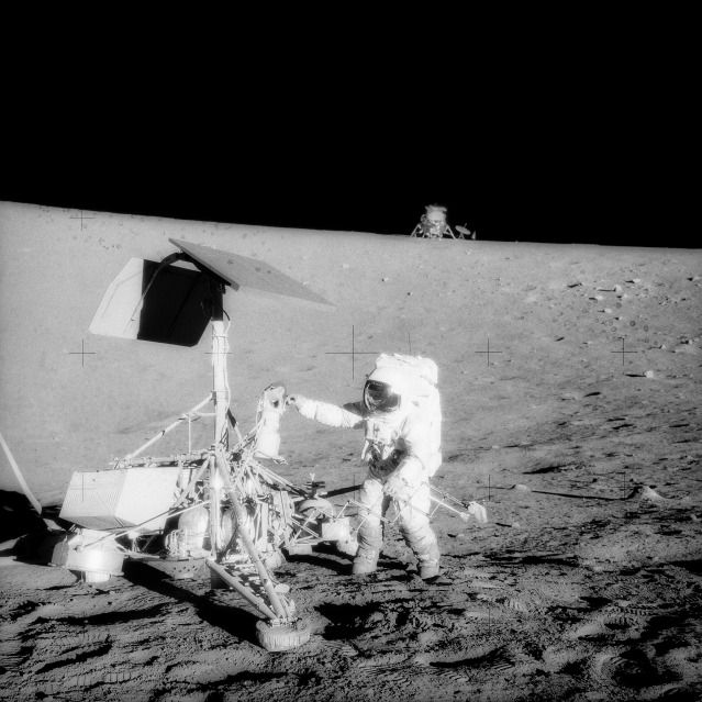
    When Apollo 12 landed in the Ocean of Storms in November 1969, Pete Conrad and Alan Bean came down within walking distance of a spacecraft that had been there since April 1967. Surveyor 3 was no longer operating, but its hardware still had scientific value.

    On their second moonwalk, the astronauts visited the robotic lander and removed several components, including its television camera and soil scoop. Back on Earth, investigators could examine actual hardware that had spent more than two years on the lunar surface rather than rely on photographs or chamber tests alone.

    The retrieved parts offered a record of one environment and one mission, not a blanket prediction of how all hardware would fare on the Moon. Getting close enough to bring them home was an experiment in its own right: a precise landing let a crew revisit a robot’s work and return material that the robot itself was never designed to send back.

    Sources: NASA mission history and NASA photograph and description. Featured photograph: NASA.

  • Datil, 1950: A UFO Photograph Reclassified Through a Later Comet Comparison

    Datil, 1950: A UFO Photograph Reclassified Through a Later Comet Comparison

    The Datil, New Mexico, UFO file illustrates a complication in historical case labels: an explanation can arrive long after the observation, using evidence unavailable to the original investigators.

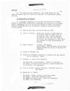
    Corporal Lertis E. Stanfield of the 3024th Air Police Squadron at Holloman reported a photographed object on February 24–25, 1950. The National Archives reproduces a three-page investigation dated March 7. Project Grudge did not establish an explanation at the time.

    A later comparison changed the classification

    According to the Archives’ 2018 review of the file, a similar-looking Soviet photograph and photographs of known comets later supplied a different interpretive context. Project Blue Book ultimately treated the Datil object as a comet, roughly a decade and a half after the original report.

    The distinction matters: similarity between images is an argument for an identification, not a newly obtained measurement of the photographed object’s distance or trajectory. The later assessment should not be rewritten as something the first investigation had already demonstrated.

    How to read the changing record

    There are two questions here. What could investigators establish in 1950? And how persuasive was the later comparison? The first can remain limited even when a subsequent reviewer favors a natural explanation. Conversely, the initial lack of an explanation is not evidence that an extraordinary craft was present.

    Readers should examine the reproduced reports rather than treating either the original uncertainty or the later label as the entire story. This is a review of an archival case, not a new observation or new government release.

    Source: National Archives review, including the March 7, 1950 investigation scans.

    Featured image: First page of the U.S. Air Force investigation, March 7, 1950. National Archives, Identifier 595175. Public-domain government record.