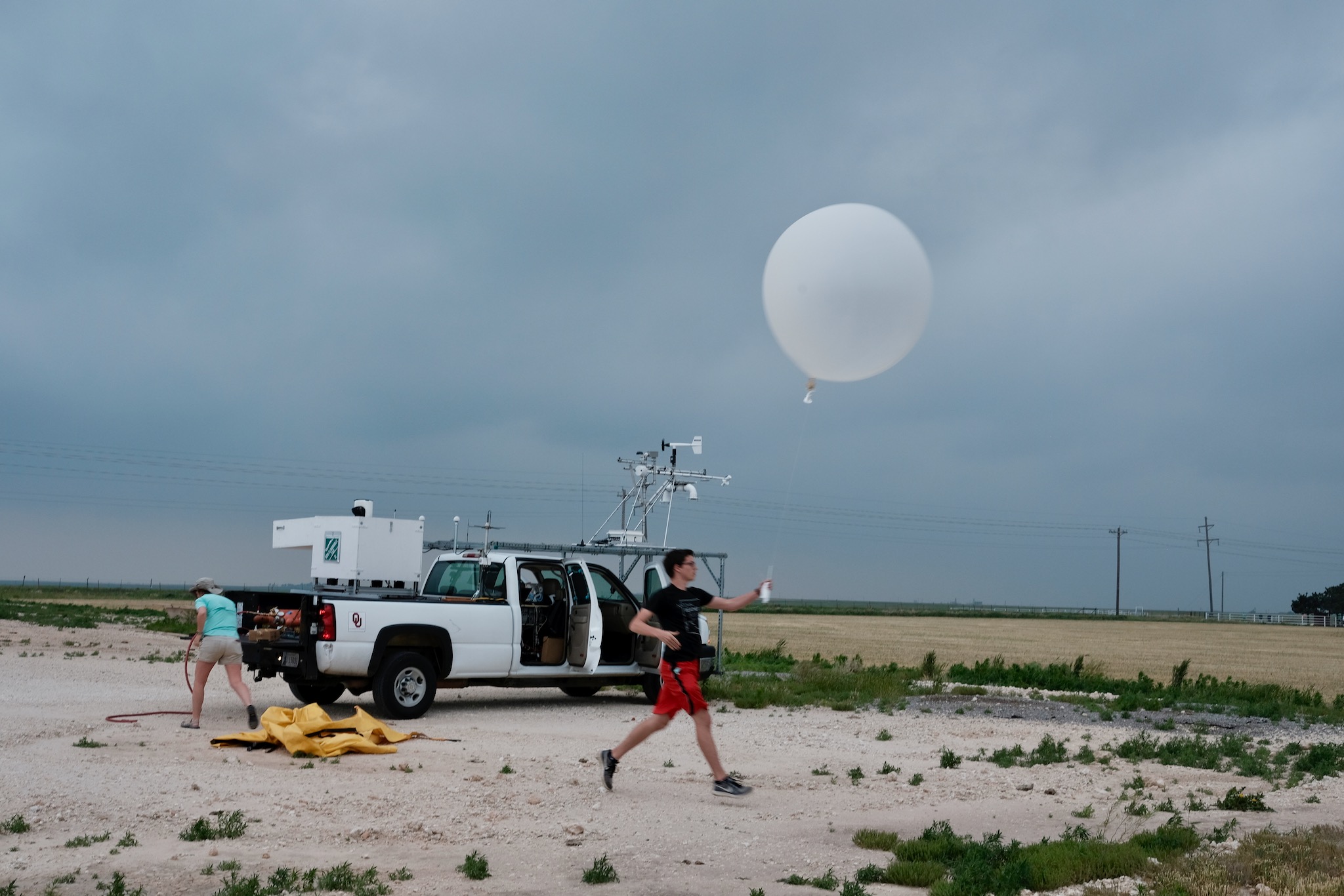
An unfamiliar object appears to move against the breeze felt by an observer. Does that rule out a balloon? Only if that breeze represents the air at the object’s actual height and location. For an elevated object, a surface weather report is a starting point rather than a complete test of wind-driven motion.
A rising balloon samples changing conditions
Weather balloons carry instrument packages called radiosondes. The National Weather Service describes an approximate ascent rate of 300 metres per minute and explains that tracking the package provides wind speed and direction aloft. A flight can last more than two hours and travel hundreds of kilometres from its launch point. Those figures describe typical sounding operations, not a fixed trajectory for every balloon. See the NWS radiosonde factsheet.
As a balloon rises, it encounters successive layers of air. Wind speed and direction can differ between those layers, so its horizontal track can curve without powered steering. NOAA’s radar-velocity guide illustrates winds changing direction with height and identifies that change as wind shear. A surface flag cannot reveal the entire profile above it.
Ascent adds another ingredient. Even in weak horizontal wind, a buoyant balloon can gain height. Its vertical motion should not be judged as though it were simply a leaf carried horizontally past a weather station. Conversely, knowing that balloons rise does not establish that any particular rising light or shape is a balloon.
A simple trajectory example
Suppose, for illustration, a balloon rises steadily at 300 metres per minute. It would gain about 3 kilometres in ten minutes. If its horizontal drift averaged 15 metres per second over those ten minutes, it would also move about 9 kilometres horizontally: 15 × 600 = 9,000 metres. Those speeds and the constant-ascent assumption are chosen for arithmetic, not reconstructed from an incident.
If the wind changes direction halfway through the climb, applying one wind vector to the whole interval gives the wrong endpoint. A more useful calculation divides the ascent into shorter periods, applies a wind estimate appropriate to each height and time, and adds the resulting displacements. Uncertainty in launch position, ascent rate and winds should produce a range of possible tracks rather than a single apparently exact line.
Test the balloon hypothesis with the right records
Start with the sighting’s time, observer location, viewing direction and any supported altitude estimate. Then seek nearby upper-air observations and candidate launch records. NOAA’s Integrated Global Radiosonde Archive includes wind direction, wind speed, height information and elapsed time since launch. Its documentation also warns that vertical and temporal resolution vary.
A sounding is not a simultaneous measurement of every point overhead. The instrument moves while it climbs, and a nearby station may sample a different air mass or time. Model wind profiles can help fill gaps, but they remain estimates. Comparing several plausible heights is especially important when the object’s altitude is unknown.
A credible match joins the launch time and location to a plausible trajectory, then checks whether that trajectory agrees with the observed direction and timing. Agreement with winds supports a balloon explanation but does not uniquely identify the object. A mismatch with ground-level wind alone is weak grounds for rejecting it. The useful question is whether the full set of observations fits a realistic flight through the atmosphere.
Leave a Reply