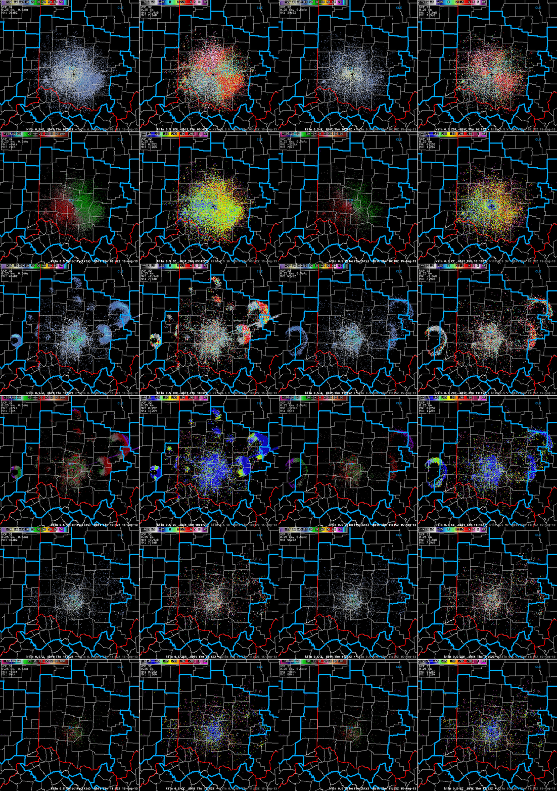
An expanding ring on weather radar can look artificial, yet its cause may be thousands of birds leaving a shared roost. Unlike an electronic artifact, this is a detection of physical targets. The unusual geometry comes from many animals dispersing in different directions at dawn.
A pattern with a biological explanation
The National Weather Service’s Wilmington office documents recurring rings on August 2–3, 2010 and August 15, 2013. Birds climbing into the radar beam become visible; spreading out and moving out of the sampled altitude makes the ring weaken. A separate Green Bay example records departures from Green Island in 2006 and 2010.
Repeated locations and timing near sunrise are useful clues. They are not a rule that every circular radar pattern must be birds. Weather, beam geometry and other targets still matter.
More than one radar product
Wilmington’s four-panel 2013 example adds correlation coefficient to reflectivity and velocity. Low correlation coefficient indicates varied scattering characteristics consistent with non-weather targets in this case. It helps separate the roost echoes from more uniform precipitation, but is not by itself a species detector.
That distinction matters when interpreting unidentified radar returns. A real echo does not automatically mean a vehicle, and a puzzling pattern need not be a faulty instrument. Biological targets offer a third possibility that should be tested against the time sequence and supporting data.
For an unfamiliar screenshot, ask for the full sequence, radar location, timestamp and product names before inferring motion or identity. A cropped still loses the sunrise-linked expansion that makes these examples understandable.
Sources: NWS Wilmington’s roost-ring explanation and multi-product animation; NWS Green Bay’s Green Island observations.
Featured image: NWS Wilmington dual-polarization radar sequence, August 15, 2013. Reflectivity upper left, differential reflectivity upper right, velocity lower left and correlation coefficient lower right. Credit: NOAA/National Weather Service.
Leave a Reply