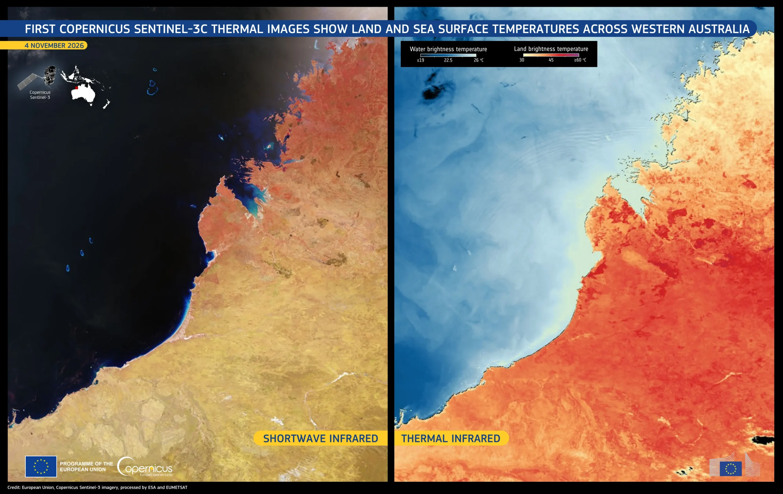
ESA released the first thermal imagery from Sentinel-3C’s Sea and Land Surface Temperature Radiometer on November 18, 2026. The milestone tests a different instrument capability from the satellite’s earlier optical views, and does not mean commissioning is complete.
Two views of Western Australia
A November 4 acquisition covers the Kimberley region. The accompanying Copernicus graphic places a shortwave-infrared view on the left and a thermal view on the right. They encode different information: the former helps distinguish land-cover features, while thermal colors depict brightness-temperature contrasts.
Brightness temperature is derived from radiation reaching the instrument at the top of the atmosphere. It should not be read as a direct thermometer measurement at every colored patch of ground. Nor are the false colors the landscape’s appearance to a human observer.
First images are a milestone, not the finish
Sentinel-3C launched on September 15. Its radiometer has nine spectral bands and two additional channels dedicated to detecting fires. The November release also includes imagery acquired November 2 over southwestern Europe and northern Africa.
The new views demonstrate that the instrument is producing useful observations, but calibration and commissioning remain distinct from a successful first image. That distinction is important for a mission intended to contribute consistent measurements over time.
Sources: ESA’s first-radiometer-images release; European Union Copernicus image description.
Featured image: Kimberley region, Western Australia, November 4, 2026; shortwave infrared at left and thermal infrared at right. Contains modified Copernicus Sentinel data 2026. Credit: European Union, processed by ESA and EUMETSAT. This is satellite observation imagery, not an artist’s illustration.
Leave a Reply