Researchers and the public can now explore a much larger record of what the Artemis II crew saw during its April journey around the Moon. NASA announced the release of more than 800 gigabytes of lunar science data on October 7, 2026, opening the observations to further analysis.
The collection includes more than 11,000 full-resolution images and video, 8.5 hours of recorded scientific observations, and pictures annotated by the crew. NASA also released a preliminary science report, an operations report and a data user guide alongside the archive.
According to the release announcement, the combination preserves an important human contribution: astronauts could choose targets as events unfolded, describe subtle changes and record observations that complement their photographs.
Following the observations
The Planetary Data System’s Artemis II page provides a starting point. It links separate collections for handheld cameras, Orion’s cameras, mission audio and supporting documents. Search tools allow users to narrow imagery by criteria such as camera, observation time and processing level.
The archive also contains measurements of temperature and humidity in Orion’s storage lockers. That material sits alongside the mission documentation at the PDS Geosciences Node; the imagery and audio are hosted by the Cartography and Imaging Sciences Node.
This is the first delivery, with additions still pending. The archive page says the SPICE navigation and observation-geometry bundle is delayed. The user guide separately notes that iPhone imagery was still being prepared when the guide was released.
A flyby preserved in detail
The data user guide describes the main lunar observing window as approximately 6.75 hours around the April 6 flyby. Its science objectives include investigating impact flashes, variations in surface color and reflectivity, crater structures, and the broader setting of potential future landing sites.
The guide matters because a photograph’s meaning depends on how and when it was taken. It explains the instruments, observation sequences, archive organization and processing needed to work with the files. Reading that context makes the collection more useful than treating every frame as a standalone picture.
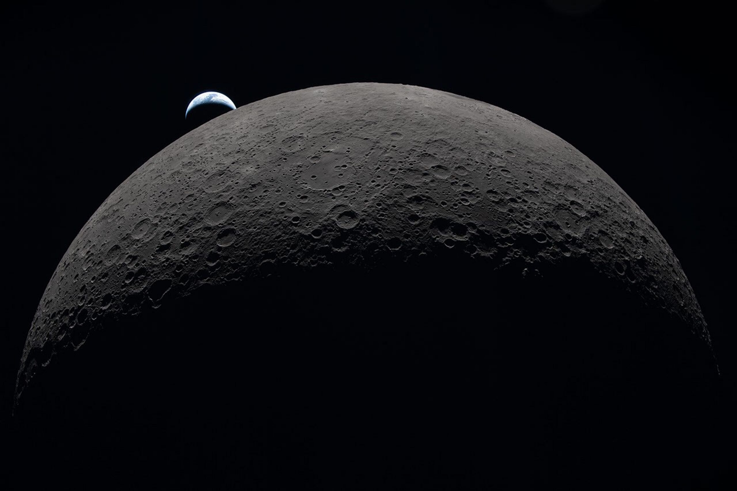
One familiar example is the crew’s Earthset view, photographed on April 6 and published by NASA the following day. The lunar terrain in those images was also the subject of descriptions of craters, old lava flows, fractures and changes in brightness and texture. With the new archive, those observations can be examined together, preserving both the view and the record of what the astronauts noticed.
Featured image: Earth appears beyond the Moon’s cratered surface in a view photographed by the Artemis II crew on April 6, 2026. Credit: NASA. Image source. NASA image usage terms.
Leave a Reply