A bright line across the sky can change long after the aircraft that made it has disappeared. It can widen, break into separate pieces or turn orange near sunset. Those changes make contrails useful subjects for careful observation, but poor evidence for an extraordinary aircraft maneuver on their own.
This is an evergreen guide to interpreting aircraft condensation trails, not a report of a new UAP incident. The first distinction is between the aircraft and the cloud it leaves behind. They no longer have to occupy the same place or follow the same motion.
The air at flight altitude sets the conditions
The Federal Aviation Administration explains that contrails consist of ice crystals formed when aircraft exhaust mixes with sufficiently cold, humid air. Conditions at cruising altitude can differ sharply from conditions on the ground. A dry afternoon at your location therefore does not rule out a persistent trail far above it.
A trail can appear to start or stop when an aircraft crosses a boundary between air masses. The visible gap does not, by itself, show that a pilot switched a special system on or off. It records where the atmosphere supported a visible cloud.
A line becomes a cloud
The National Weather Service discussion of clouds and contrails shows how winds aloft can spread a trail into a broader cloud layer. The aircraft moves on while the ice remains subject to wind and turbulence. An old trail may consequently sit far from the route displayed on a current flight map.
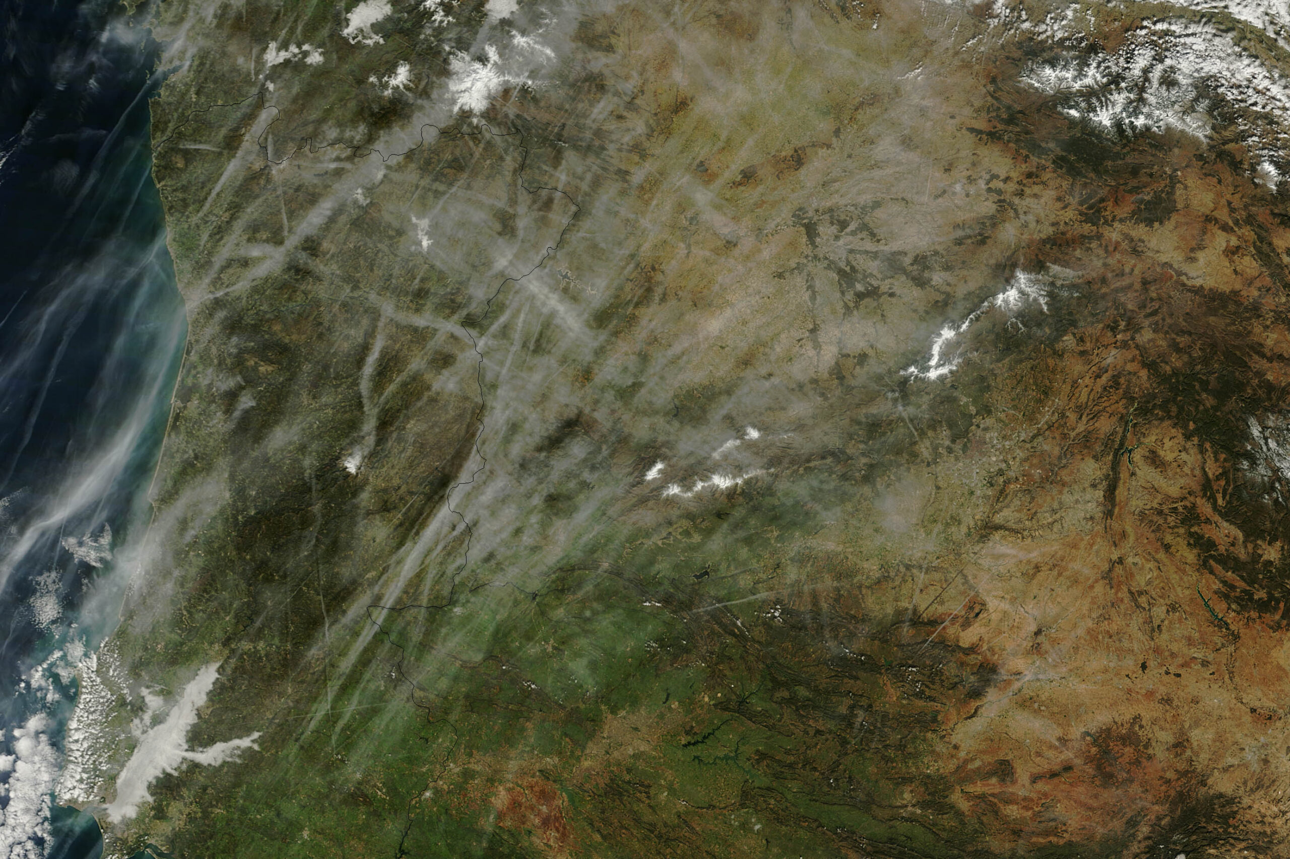
NASA documented this process in a Terra satellite view of Portugal and Spain acquired on February 15, 2013. The archival image illustrates how numerous flight paths can leave an overlapping cloud pattern. It is not imagery of a present-day event.
Color and perspective need their own checks
The FAA notes that illumination can give contrails red, orange, yellow or gray appearances as the Sun changes position. A glowing trail is not automatically burning debris. A photograph also collapses depth: two lines that cross in an image need not intersect at the same altitude.
For a useful record, save the original images and note the location, time zone, viewing direction, Sun position and elapsed time between frames. Include a wide view with a fixed landmark. Describe separately what the leading point did and how the trail changed. If no leading object was seen, say so.
These checks do not identify every unusual streak. Rockets, meteors and ordinary clouds require different tests. They do prevent a common mistake: treating the changing shape of a wind-driven cloud as a direct measurement of a vehicle.
Featured image: NASA/Jeff Schmaltz, LANCE/EOSDIS MODIS Rapid Response; February 15, 2013. Archival satellite image and source.
Leave a Reply